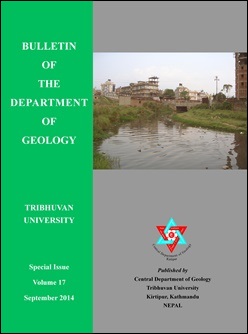
Riverbank erosion potential and channel stability status of the Kodku River, southern Kathmandu Basin, Central Nepal
DOI:
https://doi.org/10.3126/bdg.v17i0.12723Keywords:
Streambank erosion, channel stability, Kodku River, Bank erosion hazard index, near bank stressAbstract
The Kodku River is a southern tributary of the Manahara River and extends for about 15.86 km with 35.67 sq. km of watershed area. It is quite a potential linkage between the hilly, southern Kathmandu and the urban, inner Kathmandu. The river corridors are frequently subject to bank erosion, slope movements and flash flooding. Riverbank erosion is an important cause of toe erosion of slopes causing landslides and also posing threat on the infrastructures. Stream channel stability is crucial to understand overall river stability. Recognition of existing stability condition of river is to understand nature and behavior of the river, and is important in many ways: (a) to recognize the bank erosion and lateral instability hazard, (b) to develop infrastructure along or nearby the river corridor, (c) to start on where to restore the river, (d) to develop reservoir and exploit natural resources, and (e) to develop safe settlement areas. The Kodku River is a gravelly mixed-load meandering river. Level II classification distinguishes the Badikhel Segment as a ‘B4c’ type stream, the Taukhel Segment as a ‘C6c’ type, and the fifth order segments such as the Arubot, Thaiba and Harisidhi Segments as ‘C4c’ type streams. The ‘B4c’ type stream is entrenched and somewhat laterally confined by steep valley slopes and terrace landforms. It has the highest unit stream power (16.64 Nm/ s/m2), high potential of bed material scouring and tendency of vertical instability. The ‘C6c’ type stream is a meandering stream with shallow channel and wide valley. The ‘C4c’ type streams have shallow and wide meandering channels with well developed flood plains and lateral bars, and have the least unit stream power (in Harishiddi Segment 0.11N-m/s/m2), low potential of river bed material erosion but have tendency of lateral instabilities. The bank erosion hazard map indicates that the upper third order stretch and few downstream stretches lie in low hazard zone, but the overall areas of the Harisidhi Segment, Gwarko, Imadol and some other areas lie in high to very high hazard zone because of devegetation, modification of channels and other anthropogenic activities in addition to the weak nature of the bank materials.
DOI: http://dx.doi.org/10.3126/bdg.v17i0.12723
Bulletin of the Department of Geology, Vol. 17, 2014, pp. 1-41
Downloads
Downloads
Published
How to Cite
Issue
Section
License
© Central Department of Geology, Tribhuvan University, Nepal

